15524 – Sam Rayburn Reservoir near Shirley Creek15524 – Sam Rayburn Reservoir near Shirley Creek15524 – Sam Rayburn Reservoir near Shirley Creek15524 – Sam Rayburn Reservoir near Shirley Creek
  • About Us
      • ABOUT ANRA
      • Mission & Purpose
      • Enabling Legislation & Statutes
      • History
      • ORGANIZATION
      • ANRA Jurisdiction
      • Governance
      • Meet the Board
      • Meet the Management Team
      • Board Meetings
      • DOING BUSINESS WITH ANRA
      • Solicitations
      • Vendor Information
      • Conflict of Interest
      • Economic Development
      • EMPLOYMENT
      • Job Opportunities
      • How to Apply
      • ADDITIONAL RESOURCES & LINKS
      • Texas Water Development Board
      • Texas Parks & Wildlife
      • Texas Rural Water Association
      • Texas Commission on Environmental Quality
      • Texas Veterans’ Portal
  • Services & Projects
      • WATER & SEWER SERVICE
      • Holmwood Utilities
      • Prairie Grove Utilities
      • Redland Wholesale Utilities
      • North Angelina County Regional WWTF
      • Angelina County Fresh Water Supply District #1
      • CCN Service Area Viewer
      • COMPOST
      • Soil Therapy Compost
      • Neches Compost Facility
      • Biosolid Disposal
      • Wood Waste Disposal
      • Quality Assurance
      • Public Sales
      • OSSF PROGRAM
      • OSSF Overview
      • Permits & Licensing
      • Complaints
      • Authorized Installers & Providers
      • ENVIRONMENTAL LABORATORY
      • Laboratory Information
      • Business Customers: Forms & Instructions
      • General Customers: Forms & Instructions
      • Frequently Asked Questions
      • RESERVOIRS
      • Lake Columbia
  • News & Information
      • NEWS
      • Recent News & Notices
      • Job Opportunities
      • PUBLIC INFORMATION
      • Public Information Requests
      • Financial Information
      • EDUCATION & OUTREACH
      • Programs & Projects
      • Coloring & Activity Books
      • Educational Videos
      • Lesson Plans & Modules
      • Request a Presentation
      • PUBLICATIONS & REPORTS
      • Publications & Reports
      • DATA
      • Stream Gages
      • Reservoir Levels
      • Monitoring Sites
      • Maps
      • COMMUNICATION
      • Contact Us
      • Events
  • Conservation & Recreation
      • WATER QUALITY ACTIVITIES
      • Clean Rivers Program
      • Monitoring Sites & Water Quality Data
      • Clean Water Act
      • Water Quality Education and Outreach
      • Environmental Investigations
      • WATER CONSERVATION & DROUGHT CONTINGENCY PLANNING
      • Tips to Conserve Water
      • Reservoir Levels
      • U.S. Drought Monitor Map
      • Regional Water Planning
  • Bill Pay
      • ONLINE BILL PAY
      • Pay Now
      • Set Up Autopay
      • Online Bill Pay FAQ
      • GENERAL BILL PAY INFORMATION
      • General Bill Pay FAQ
✕
            No results See all results

            15524 – Sam Rayburn Reservoir near Shirley Creek

            • Home
            • Conservation & Recreation
            • Water Quality Activities
            • Monitoring Sites & Water Quality Data
            • 15524 – Sam Rayburn Reservoir near Shirley Creek
              Show all

              15524 – Sam Rayburn Reservoir near Shirley Creek

              October 28, 2022
              Categories
              Tags

                Sam Rayburn Reservoir near Shirley Creek - TCEQ ID: 15524

                Site Description

                Sam Rayburn Reservoir near Shirley Creek in the Angelina River Channel.

                Segment Description

                Segment 0610 – Sam Rayburn Reservoir. This segment includes 106,666 acres from Sam Rayburn Dam in Jasper County to a point 5.6 kilometers (3.5 miles) upstream of Marion’s Ferry on the Angelina River Arm in Angelina/Nacogdoches County and to a point 3.9 km (2.4 miles) downstream of Curry Creek on the Attoyac Bayou Arm in Nacogdoches. Construction of the dam began in 1956 for the purpose of hydroelectric power generation, flood control, municipal/industrial/agricultural water conservation, and recreational uses. The designated uses are general use, high aquatic life use, public water supply use, contact recreation, and fish consumption. Located around Sam Rayburn are various contact recreational areas including trails, campgrounds, boating ramps, marinas, designated swimming areas, and group areas.

                Monitoring Performed Quarterly
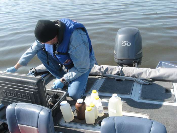
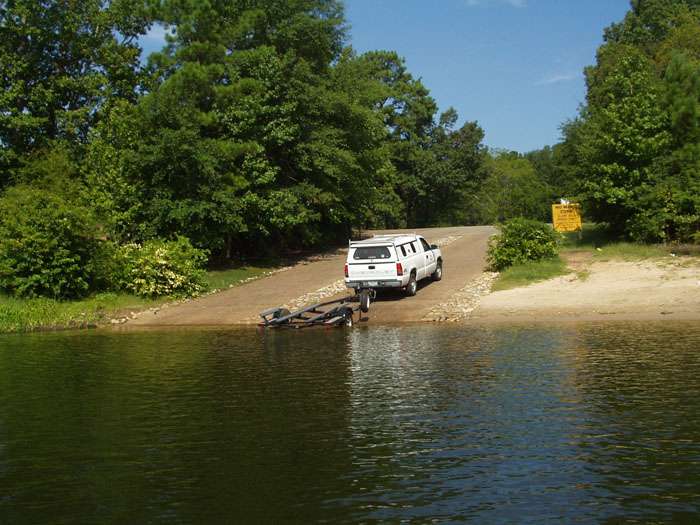
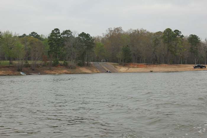
                Field Parameters
                Days Since Last Significant Rainfall
                Dissolved Oxygen
                Flow Severity
                Instantaneous Stream Flow
                pH
                Present Weather
                Secchi Transparency
                Specific Conductance
                Total Water Depth
                Water Temperature
                Conventional Parameters
                Ammonia-N
                Chloride
                Chlorophyll-a
                Pheophytin-a
                Sulfate
                Total Dissolved Solids (TDS)
                Total Nitrate+Nitrite
                Total Phosphorus
                Total Suspended Solids (TSS)
                Bacterial Parameters
                E. coli


                Photos


                click here to open in a new window

                360 Degree View


                Map


                Monitoring Stations

                0604 - Neches River below Lake Palestine
                • 10478 – Cedar Creek at FM 2497
                • 10479 – Cedar Creek at Loop 287
                • 10487 – Hurricane Creek at Loop 287
                • 10492 – Jack Creek at FM 2497
                • 10493 – Jack Creek at SH 94
                • 10494- Jack Creek at FM 3150
                • 10499 – Biloxi Creek at County Road 216
                • 10585 – Neches River at US 69
                • 13528 – Cedar Creek at FM 1336
                • 13529 – Hurricane Creek at SH 324
                • 16096 – Piney Creek at FM 358
                • 16097 – Biloxi Creek at FM 1818
                • 16098 – Buck Creek at FM 1818
                • 17339 – Lake Ratcliff
                • 21433 – Hurricane Creek below Kiwanis Park
                • 21434 – Cedar Creek at Ellis Ave
                0610 - Sam Rayburn
                • 15361 – Ayish Bayou at SH 103
                • 15523 – Sam Rayburn Reservoir Adjacent To Alligator Cove
                • 15524 – Sam Rayburn Reservoir near Shirley Creek
                • 21100 – Sam Rayburn Reservoir downstream of Marion’s Ferry
                • 21431 – Ayish Bayou at West Columbia Street
                • 21432 – Carrizo Bayou at SH 21
                0611 - Angelina River above Rayburn
                • 10474 – La Nana Bayou at CR 526
                • 10532 – Mud Creek at US 84
                • 10630 – Angelina River at SH 21
                • 10633 – Angelina River at SH 204
                • 10635 – Angelina River at FM 1798
                • 14477 – Mud Creek at US 79
                • 15801 – Lake Nacogdoches, Main Pool
                • 16301 – La Nana Bayou at N Loop 224
                • 17822 – Lake Striker, Upper Lake
                • 17824 – Lake Striker, Upper Lake
                • 20792 – La Nana Bayou at East Main
                • 21021 – Lake Nacogdoches, Upper Lake
                • 21429 – Bowles Creek at CR 4194
                • 21430 – Johnson Creek at CR 476
                0612 - Attoyac Bayou
                • 10636 – Attoyac at SH 21
                • 15253 – Attoyac at SH 7
                • 16076 – Attoyac at US 59
                • 20845 – West Creek at FM 2913
                • 21435 – Lake Naconiche, Main Pool

                The Angelina & Neches River Authority shall conserve, store, control, preserve, use, and distribute the stormwater, floodwater, and the water of the rivers and streams of the state in the Neches River Basin for the benefit of the human environment and the natural environment.

                Latest News

                • Upcoming Public Meeting for Implementation Plan for five Total Maximum Daily Loads for Indicator Bacteria in Hillebrandt Bayou and Neches River Tidal
                  February 17, 2023
                • Upcoming Public Meeting for Implementation Plan for four Total Maximum Daily Loads for Indicator Bacteria in Tributaries of the Neches River below Lake Palestine
                  February 17, 2023
                • Boil Water Notice Rescinded for Prairie Grove Utilities
                  December 28, 2022
                • Prairie Grove Utilities – Extreme Winter Weather Update #13
                  December 27, 2022
                • Prairie Grove Utilities – Extreme Winter Weather Update #12
                  December 27, 2022

                Popular Pages

                • Bill Pay
                • On-Site Sewage Facilities
                • Stream Gages
                • Reservoir Levels
                • Employment
                © 2022 Angelina & Neches River Authority.
                Website Design & Development MasseyMedia, Inc.